Solukhumbu District (Solukhumbū)
Solukhumbu District (सोलुखुम्बु जिल्ला, Sherpa: , Wylie: shar khum bu dzong) is one of 14 districts of Province No. 1 of eastern Nepal. As the name suggests, it consists of the subregions Solu and Khumbu.
The district, with Salleri as its headquarters, covers an area of 3,312 km2 and had a population 107,686 in 2001 and 105,886 in 2011.
Mount Everest is in the northern part of this district, within Sagarmatha National Park.
Historically, Solukhumbu was part of Kirata Kingdoms in early and medieval era. It was a part of Majh Kirat Khambuwan (central province or region of Kirat Kingdoms).
Before the unification of Nepal by king of Gorkha, what is now Solukhumbu district was part of Chaudandi of Majh Kirat (Khambuwan). In 1773 AD the King of Gorkha attacked and absorbed it into Nepal.
The Solukhumbu district was established in 1962 carving out the old East No. 3 district. Before 1962 present Solukhumbu, Okhaldhunga and some parts of Khotang previously were one district "East No. 3". Solu and Rawa thums (counties) were carved out from East No. 3 to create Solukhumbu District.
Map - Solukhumbu District (Solukhumbū)
Map


Country - Nepal
 |
 |
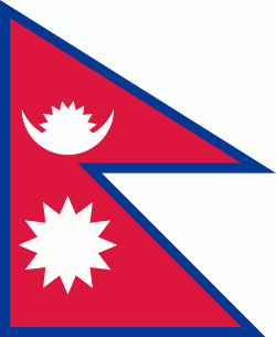
| Flag of Nepal | |
The name "Nepal" is first recorded in texts from the Vedic period of the Indian subcontinent, the era in ancient Nepal when Hinduism was founded, the predominant religion of the country. In the middle of the first millennium BC, Gautama Buddha, the founder of Buddhism, was born in Lumbini in southern Nepal. Parts of northern Nepal were intertwined with the culture of Tibet. The centrally located Kathmandu Valley is intertwined with the culture of Indo-Aryans, and was the seat of the prosperous Newar confederacy known as Nepal Mandala. The Himalayan branch of the ancient Silk Road was dominated by the valley's traders. The cosmopolitan region developed distinct traditional art and architecture. By the 18th century, the Gorkha Kingdom achieved the unification of Nepal. The Shah dynasty established the Kingdom of Nepal and later formed an alliance with the British Empire, under its Rana dynasty of premiers. The country was never colonised but served as a buffer state between Imperial China and British India. Parliamentary democracy was introduced in 1951 but was twice suspended by Nepalese monarchs, in 1960 and 2005. The Nepalese Civil War in the 1990s and early 2000s resulted in the establishment of a secular republic in 2008, ending the world's last Hindu monarchy.
Currency / Language
| ISO | Currency | Symbol | Significant figures |
|---|---|---|---|
| NPR | Nepalese rupee | ₨ | 2 |
| ISO | Language |
|---|---|
| EN | English language |
| NE | Nepali language |